Hurricane Harvey will bring rain and storms to Central Alabama over the next few days.
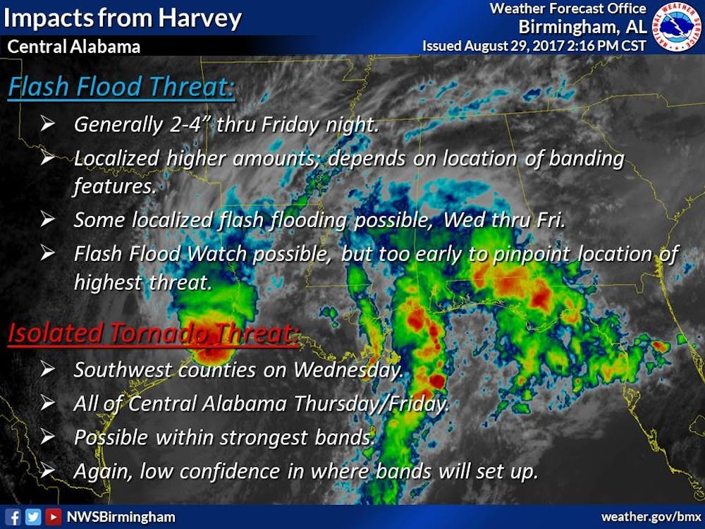
The main threat is localized flash flooding and isolated tornadoes Wednesday through Friday.
According to the National Weather service, Confidence is low at this time due to uncertainty in where banding features will develop. Both threats will be highest within the strongest bands.
THE STORM
Hurricane Harvey's main impact has been felt in Texas where record setting rain fall has caused a disaster situation in the area.
Harvey has has now set a preliminary record, surpassing 50 inches for the greatest amount of measured single-storm rainfall for the continental US. Additional rainfall accumulations of 6 to 12 inches are expected to the north and east of Houston from far east Texas into southwestern Louisiana. This is producing devastating flooding. Numerous Flash Flood Warnings are in effect.
The storm is not over yet, Harvey is expected to make a third land fall near the boarder of Texas and Louisiana.
This is a developing story continue to check EagleEyeAuburn.com for more updates.